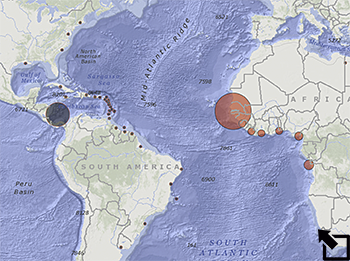
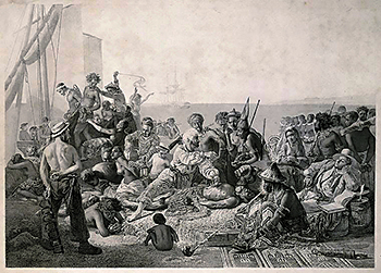
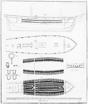
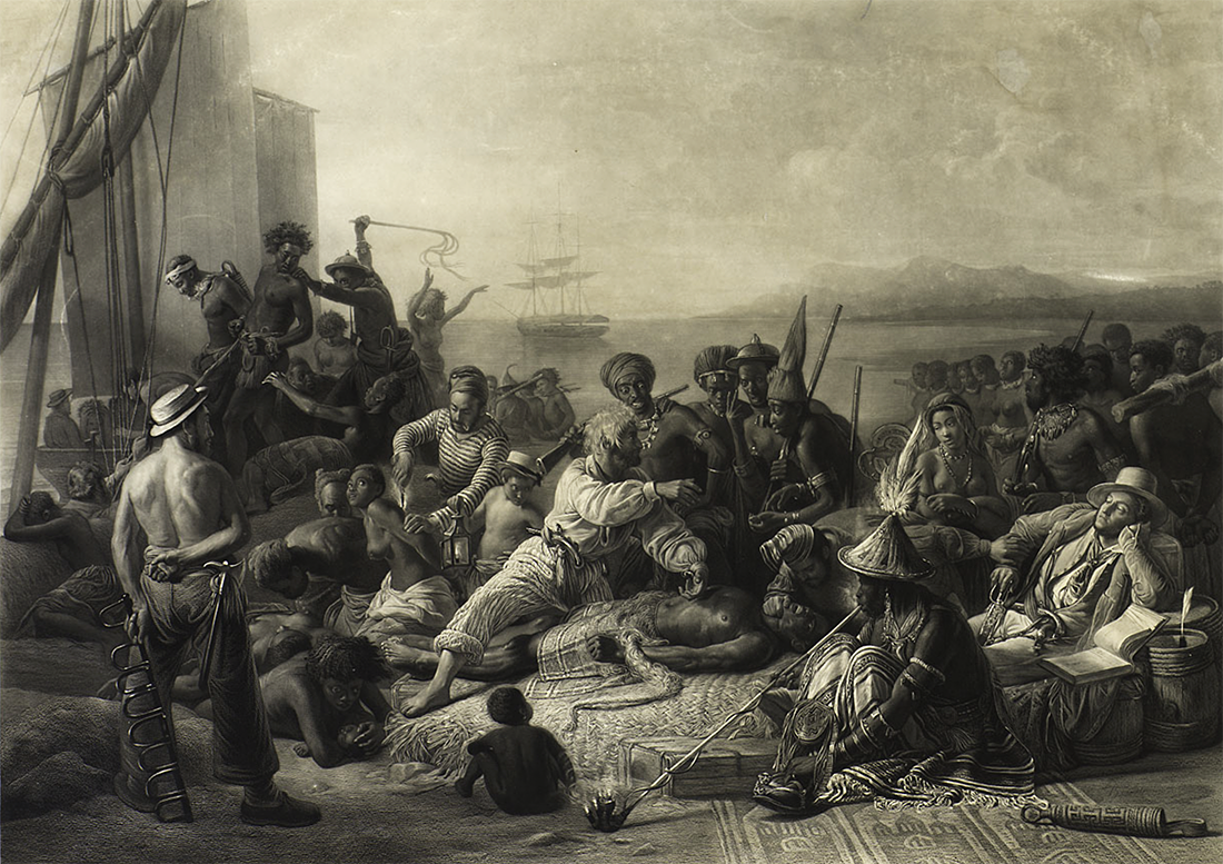
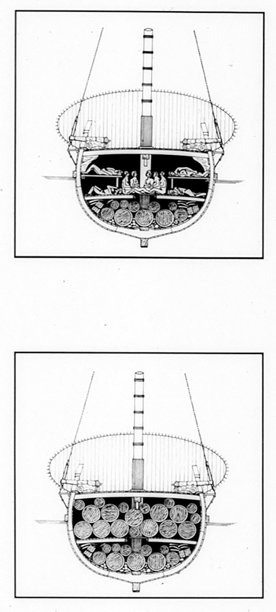
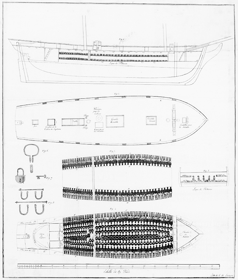
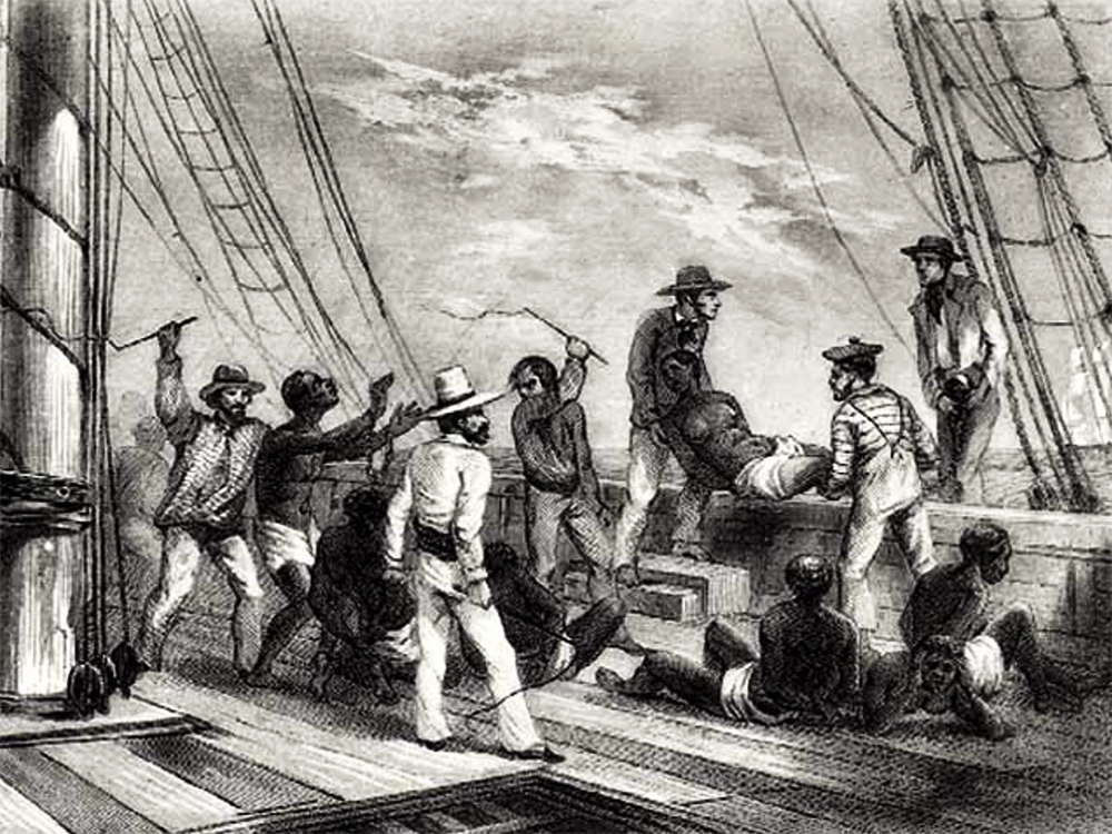
Equiano's narrative below provides a vivid picture of the middle passage - shipboard transport of slaves from the African coast to the Americas.
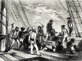
I now saw myself deprived of all chance of returning to my native country, or even the least glimpse of hope of gaining the shore, which I now considered as friendly; and I even wished for my former slavery in preference to my present situation, which was filled with horrors of every kind, still heightened by my ignorance of what I was to undergo. I was not long suffered to indulge my grief; I was soon put down under the decks, and there I received such a salutation in my nostrils as I had never experienced in my life: so that, with the loathsomeness of the stench, and crying together, I became so sick and low that I was not able to eat, nor had I the least desire to taste anything. I now wished for the last friend, death, to relieve me; but soon, to my grief, two of the white men offered me eatables; and, on my refusing to eat, one of them held me fast by the hands, and laid me across, I think, the windlass, and tied my feet, while the other flogged me severely. I had never experienced anything of this kind before, and, although not being used to the water, I naturally feared that element the first time I saw it, yet, nevertheless, could I have got over the nettings, I would have jumped over the side, but I could not; and besides, the crew used to watch us very closely who were not chained down to the decks, lest we should leap into the water; and I have seen some of these poor African prisoners most severely cut, for attempting to do so, and hourly whipped for not eating. This indeed was often the case with myself.
In a little time after, amongst the poor chained men, I found some of my own nation, which in a small degree gave ease to my mind. I inquired of these what was to be done with us? They gave me to understand, we were to be carried to these white people's country to work for them. I then was a little revived, and thought, if it were no worse than working, my situation was not so desperate; but still I feared I should be put to death, the white people looked and acted, as I thought, in so savage a manner; for I had never seen among any people such instances of brutal cruelty; and this not only shown towards us blacks, but also to some of the whites themselves. One white man in particular I saw, when we were permitted to be on deck, flogged so unmercifully with a large rope near the foremast, that he died in consequence of it; and they tossed him over the side as they would have done a brute. This made me fear these people the more; and I expected nothing less than to be treated in the same manner. I could not help expressing my fears and apprehensions to some of my countrymen; I asked them if these people had no country, but lived in this hollow place (the ship)? They told me they did not, but came from a distant one. "Then," said I, "how comes it in all our country we never heard of them?" They told me because they lived so very far off. I then asked where were their women? had they any like themselves? I was told they had. "And why," said I, "do we not see them?" They answered, because they were left behind. I asked how the vessel could go? They told me they could not tell; but that there was cloth put upon the masts by the help of the ropes I saw, and then the vessel went on; and the white men had some spell or magic they put in the water when they liked, in order to stop the vessel. I was exceedingly amazed at this account, and really thought they were spirits. I therefore wished much to be from amongst them, for I expected they would sacrifice me; but my wishes were vain -- for we were so quartered that it was impossible for any of us to make our escape.
While we stayed on the coast I was mostly on deck; and one day, to my great astonishment, I saw one of these vessels coming in with the sails up. As soon as the whites saw it, they gave a great shout, at which we were amazed; and the more so, as the vessel appeared larger by approaching nearer. At last, she came to an anchor in my sight, and when the anchor was let go, I and my countrymen who saw it, were lost in astonishment to observe the vessel stop -- and were now convinced it was done by magic. Soon after this the other ship got her boats out, and they came on board of us, and the people of both ships seemed very glad to see each other. Several of the strangers also shook hands with us black people, and made motions with their hands, signifying I suppose, we were to go to their country, but we did not understand them.
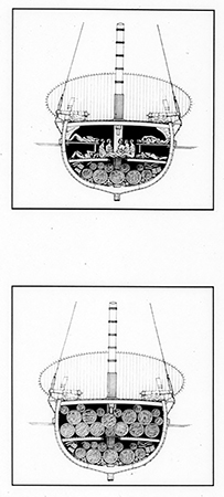
At last, when the ship we were in, had got in all her cargo, they made ready with many fearful noises, and we were all put under deck, so that we could not see how they managed the vessel. But this disappointment was the least of my sorrow. The stench of the hold while we were on the coast was so intolerably loathsome, that it was dangerous to remain there for any time, and some of us had been permitted to stay on the deck for the fresh air; but now that the whole ship's cargo were confined together, it became absolutely pestilential. The closeness of the place, and the heat of the climate, added to the number in the ship, which was so crowded that each had scarcely room to turn himself, almost suffocated us. This produced copious perspirations, so that the air soon became unfit for respiration, from a variety of loathsome smells, and brought on a sickness among the slaves, of which many died -- thus falling victims to the improvident avarice, as I may call it, of their purchasers. This wretched situation was again aggravated by the gaffing of the chains, now became insupportable, and the filth of the necessary tubs, into which the children often fell, and were almost suffocated. The shrieks of the women, and the groans of the dying, rendered the whole a scene of horror almost inconceivable. Happily perhaps, for myself, I was soon reduced so low here that it was thought necessary to keep me almost always on deck; and from my extreme youth I was not put in fetters. In this situation I expected every hour to share the fate of my companions, some of whom were almost daily brought upon deck at the point of death, which I began to hope would soon put an end to my miseries. Often did I think many of the inhabitants of the deep much more happy than myself. I envied them the freedom they enjoyed, and as often wished I could change my condition for theirs. Every circumstance I met with, served only to render my state more painful, and heightened my apprehensions, and my opinion of the cruelty of the whites.
One day they had taken a number of fishes; and when they had killed and satisfied themselves with as many as they thought fit, to our astonishment who were on deck, rather than give any of them to us to eat, as we expected, they tossed the remaining fish into the sea again, although we begged and prayed for some as well as we could, but in vain; and some of my countrymen, being pressed by hunger, took an opportunity, when they thought no one saw them, of trying to get a little privately; but they were discovered, and the attempt procured them some very severe floggings.
One day, when we had a smooth sea and moderate wind, two of my wearied countrymen who were chained together (I was near them at the time), preferring death to such a fife of misery, somehow made through the nettings and jumped into the sea; immediately, another quite dejected fellow, who, on account of his illness, was suffered to be out of irons, also followed their example; and I believe many more would very soon have done the same, if they had not been prevented by the ship's crew, who were instantly alarmed. Those of us that were the most active, were in a moment put down under the deck; and there was such a noise and confusion amongst the people of the ship as I never heard before, to stop her, and get the boat out to go after the slaves. However, two of the wretches were drowned, but they got the other, and afterwards flogged him unmercifully, for thus attempting to prefer death to slavery. In this manner we continued to undergo more hardships than I can now relate, hardships which are inseparable from this accursed trade. Many a time we were near suffocation from the want of fresh air, which we were often without for whole days together. This, and the stench of the necessary tubs, carried off many.
During our passage, I first saw flying fishes, which surprised me very much; they used frequently to fly across the ship, and many of them fell on the deck. I also now first saw the use of the quadrant; I had often with astonishment seen the mariners make observations with it, and I could not think what it meant. They at last took notice of my surprise; and one of them, willing to increase it, as well as to gratify my curiosity, made me one day look through it. The clouds appeared to me to be land, which disappeared as they passed along. This heightened my wonder; and I was now more persuaded than ever, that I was in another world, and that
every thing about me was magic.
At last we came in sight of the island of Barbadoes, at which the whites on board gave a great shout, and made many signs of joy to us. We did not know what to think of this; but as the vessel drew nearer, we plainly saw the harbor, and other ships of different kinds and sizes, and we soon anchored amongst them, off Bridgetown. Many merchants and planters now came on board, though it was in the evening. They put us in separate parcels, and examined us attentively. They also made us jump, and pointed to the land, signifying we were to go there. We thought by this, we should be eaten by these ugly men, as they appeared to us; and, when soon after we were all put down under the deck again, there was much dread and trembling among us, and nothing but bitter cries to be heard all the night from these apprehensions, insomuch, that at last the white people got some old slaves from the land to pacify us. They told us we were not to be eaten, but to work, and were soon to go on land, where we should see many of our country people. This report eased us much. And sure enough, soon after we were landed, there came to us Africans of all languages.
We were conducted immediately to the merchant's yard, where we were all pent up together, like so many sheep in a fold, without regard to sex or age. As every object was new to me, everything I saw filled me with surprise. What struck me first, was, that the houses were built with bricks and stories, and in every other respect different from those I had seen in Africa; but I was still more astonished on seeing people on horseback. I did not know what this could mean; and, indeed, I thought these people were full of nothing but magical arts. While I was in this astonishment, one of my fellow prisoners spoke to a countryman of his, about the horses, who said they were the same kind they had in their country. I understood them, though they were from a distant part of Africa; and I thought it odd I had not seen any horses there; but afterwards, when I came to converse with different Africans, I found they had many horses amongst them, and much larger than those I then saw.
We were not many days in the merchant's custody, before we were sold after their usual manner, which is this: On a signal given (as the beat of a drum), the buyers rush at once into the yard where the slaves are confined, and make choice of that parcel they like best. The noise and clamor with which this is attended, and the eagerness visible in the countenances of the buyers, serve not a little to increase the apprehension of terrified Africans, who may well be supposed to consider them as the ministers of that destruction to which they think themselves devoted. In this manner, without scruple, are relations and friends separated, most of them never to see each other again.

