Unit Objectives
- Understand the geographic and cultural reasons for the selection of the Hanford Reach area as a nuclear facility.
- Understand how exposure to radioactive waste from Hanford occurs and how it can contaminate humans.
- Use GIS software to analyze the spread of radioactive materials from Hanford and resulting health issues and describe these phenomena in narrative, graphical or mathematical terms as appropriate.
- Evaluate the health effects of exposure to radioactive waste from Hanford using both personal narratives of those affected and research studies.
Related National Standards
GIS Activities
GIS investigations are part of many of the activities in this unit. These investigations make use of ArcGIS Online, an internet software that runs on most browsers. If you do not have an an ArcGIS account and would like to have one you can sign up for a free personal account here.

The data and shapefiles in the various map layers are from a variety of sources:
Columbia River &
Oregon Counties
Cancer related data from Robert Fadeley, "Oregon Malignancy Pattern Physiographically Related to Hanford Washington Radioisotope Storage," Journal of Environmental Health 27:6:883-897, 1965 and "State Cancer Profiles," National Cancer Institute, 2011.
Oregon and Washington county shapefiles from the Oregon GEO Spatial Data Library.
Hanford &
Nearby Weather Stations
Wind rose images produced using the Western Region Climate Center's RAWS USA Climate Archive on November 7, 2011.
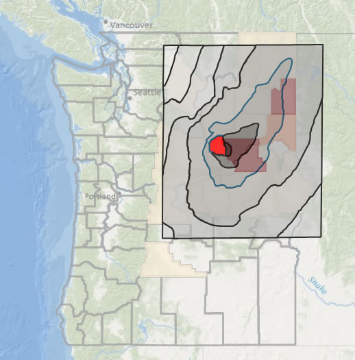
Iodine Radiation
The Technical Steering Panel of the Hanford Environmental Dose Reconstruction Project, Summary: Radiation Dose Estimates from Hanford Radioactive Material Releases to the Air and the Columbia River, April 21,1994, p 28-31.
Hypothyroidism
data from John R. Goldsmith, et. al, Juvenile Hypothyroidism among Two Populations Exposed to Radioiodine, Environmental Health Perspectives, Volume 107, Number 4, April 1999, 303-308.
Additional Resources
Michele Stenehjem Gerber, The Home Front: The Cold War Legacy of the Hanford Nuclear Site, Lincoln: University of Nebraska Press, 2007.
Susan Zwinger, The Hanford Reach: A Land of Contrasts, Tucson: The University of Arizona Press, 2004.
Last modified in May, 2024 by Rick Thomas