GIS in the History Classroom
Why GIS? - Scale
History is unlike other social and physical sciences in that students of history commonly have to deal with a relative scarcity of evidence, trusting that the evidence they do have is both reliable and that it provides a representative perspective on the story being told. In this regard, the use of extensive and detailed records from the past stored in GIS databases provide a valuable tool for creating a more thorough and nuanced picture of the past. Against such a backdrop more traditional sources can be used to flesh out and enrich the story with more confidence. This ability to make adjustments in scale between a broader picture of an entire population - a census report, for example - and the particular of, say, a diary or a collection of photographs - can be invaluable in building historical understanding and resolving the contradictions that are often inherent in individual documents.
The images and documents presented in the gallery at the right offer a mixed picture of the character of the Japanese American population following the attack on Pearl Harbor in 1941. To what degree do they represent the subjective biases of their authors? Who was their intended audience? What was the purpose of each? These types of questions are key to interpreting any historical source. The same needs to be asked of a letter, a diary, the report of a government official, the testimony of a first person participant, and of a large data base of information.
The availability of a census of all Japanese internees taken at the time of their incarceration provides a tool for creating a general and detailed picture of this population; a picture that can be weighed against documents like those above to examine and analyze the stereotypes held by many Americans both before and following the attack on Pearl Harbor. The documents included in the slide series are a sampling of those provided for student study in the Japanese Internment collection. They include materials related to:
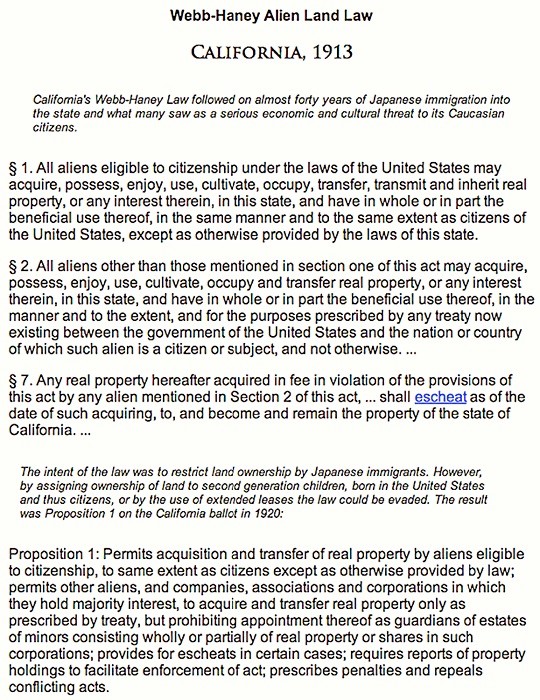
| • | constitutional and legal limitations on American citizenship related to Japanese immigrants, |
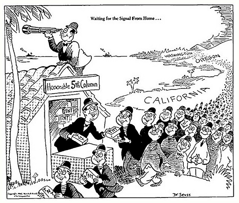
| • | images of the Japanese enemy from war time propaganda posters, |
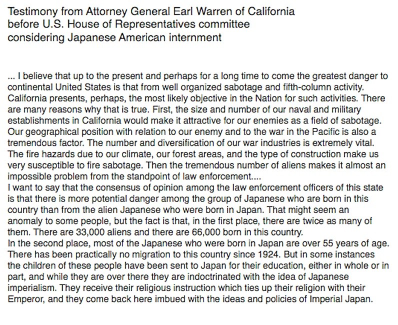
| • | official pronouncements by government and military officials regarding the dangers posed by the Japanese American population, |
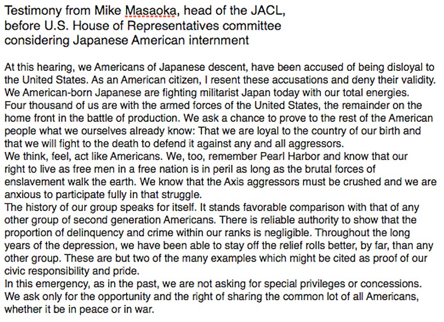
| • | and public testimony by the leader of the Japanese American Citizens League (JACL). |
These specific sources provide two points of view: that of military leaders and government officials (particularly the Attorney General of California, Earl Warren) reflecting the views of many Americans, and that of the president of the JACL (the Japanese American Citizens League) trying to impress The U.S. House of Representatives committee considering the idea of internment with the loyalty and good citizenship of the majority of the Japanese American community. How accurate is our understanding of the Japanese American community based on these particular documents and their opposing points of view?
A broader and more detailed view of the Japanese American population based on a much larger sample of information can be derived from the census data collected from the entire internee population in 1942. The Japanese Internment file contains an approximate three percent random sample of the census data from the California internee population, sufficiently small to be manageable on web based software and large enough to provide a representative picture. Student queries of the file allow for questions related to:
| • | loyalty - in terms of language fluency, parent’s place of birth, and time and schooling in Japan |
| • | strength of roots in the United States - looking at generational differences, age, educational background, and employment |
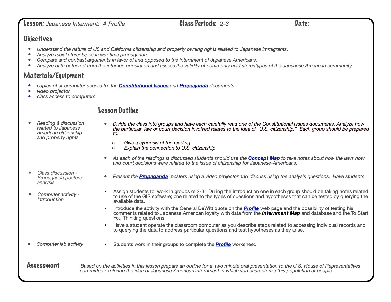
The lesson plan offered here addresses several issues related to the effective use of GIS in the history classroom. First, the historical context within which the GIS data was drawn needs to be firmly established - in this case the second class nature of the Japanese American population, the perceived threat of Japanese immigrants to the economic well being of the European American population, the impact of the attack on Pearl Harbor, and racial animosity fed by wartime propaganda. Second, classroom use of GIS software is relatively new. Provisions for teaching about its use need to be worked into the lesson. And, finally, a setting needs to be created in which students can use one another to address questions about the use of the tool and, most importantly, to use one another along with the teacher as sounding boards as new ideas are tested against the available data. The Teaching with GIS page addresses this last topic specifically.


